[email protected]
Gracious Gracious
  • Home
  • Membership
  • Club Information
    • About Us
    • Contact Us
    • New Rider Information
    • Bicycling Safety
    • Governance
      • Board of Directors
      • Terms Of Use And Privacy
      • LAB Insurance Brochure
      • Articles of Incorporation
      • CBC Bylaws
      • Discussion Forum Agreement
    • Other Cycling Groups
  • Rides and Routes
    • General Route Info
    • CBC Ride Classifications
    • Route Library
      • Paved Routes
      • Spring Hill Routes (Paved)
      • Gravel Routes
    • Cycling on the Blue Ridge
    • Major Climbs
    • Other Cycling Events In Virginia
    • Virtual Rides
  • Ride Calendar
  • Members
    • Community Forums
    • Club Photos
    • Ride With GPS Club Account
    • Membership Directory
    • Account Settings
    • Logout
  • Posts
  • Login

Charlottesville Bicycle Club

  1. Home
  2. Charlottesville Bicycle Club

Woods Mill – Nellysford

GPS
Map & Cue Sheet

Distance:  25 miles
Climbing:  120 feet per mile

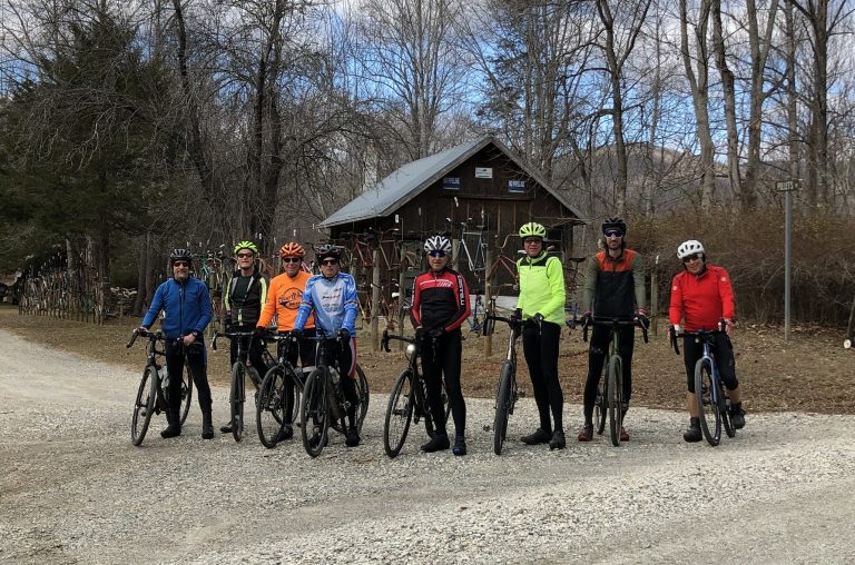
Description:  This ride is made up of two very different out-and-backs, each starting from the parking area. The first heads north toward Nellysford with 6 large rollers in each direction. Look for the house with the fence made of 30-40 bicycles at the top of one hill. After returning to the starting point, the second leg heads southwest for a gradual, steady climb along several streams. There are two options for the last 2 miles, one a bit steeper than the other. You are of course welcome to do both.

Stores:  None

Alerts:  None

Starting Point:
   Woods Mill
   Routes 776 & 613
   Faber, VA 22938
   GPS: 37.839516, -78.831563

Note:  Parking is limited.

Recent Posts

  • CBC Sponsors Spring Hill Group Road Rides
  • Make Sure You’re Seeing CBC Emails in Gmail
  • Follow Up From The Club President
  • Musings of a RWGPS user on a New Year!
  • A Letter from the President
Copyright | Charlottesville Bicycle Club,  2021-22 | A 501(c)7 Organization
  • Terms Of Use And Privacy
  • Contact Us